
Follow the road trip from the beginning here.
We woke at the crack of, well, not very early at all, in the middle of the forest in Richardson Grove State Park. Despite all the rustling in the undergrowth the night before, not one single bear had pounced on me during the night, so I actually had a pretty good night’s sleep. I’m sure the wine helped. We were slow to get started, luxuriating in folding camp chairs with steaming mugs of freshly brewed coffee for ages before ambling over to the restrooms armed with our toothbrushes. We had to wait in line for a family with five excited kids zipping around, and a lady who must have been in her eighties armed with a makeup bag the size of a small backpack. She had us in stitches, complaining about the lack of counter space for the dozens of little jars and bottles that kept magically appearing from her bag, and she left the entire wash area coated in a film of translucent power and dabs of blue eye shadow. When the bathroom finally cleared and Jill and I had the place to ourselves, we burst out laughing. We’d been on the road so long any makeup we had brought had long since been relegated to the darkest recesses of our backpacks and at this point, the best we could do was to get a brush through our tousled hair and put on sunscreen.
Jill was beside herself with excitement, because we were headed to the Lost Coast, something she had been talking about since we left. The turnoff for the Lost Coast was only a ten minute drive north of the park, although it took us a little longer because we got waylaid by The Legend of Bigfoot, an odd little roadside store selling wooden knick-knacks to spendthrift tourists, and boasting an array of unusual chainsaw carvings outside, including a rather subdued-looking Bigfoot.


We passed through Garbersville, took the exit for Redway and found the road headed for the Lost Coast. We drove along a winding, leafy lane for over 20 miles, and the further we drove, the more exasperated Jill got. “I don’t understand” she kept saying, “where’s the ocean?” I looked at the map and told her we wouldn’t reach the ocean until the end of the road. “But where’s the bit where we drive along the coast?” she asked. I didn’t know the answer, stabbing my finger at a faint line on the map that read Kings Peak Road. I hoped that was what she was thinking of, but I couldn’t quite suppress the doubt rising in my mind that maybe, just maybe, she was actually thinking of the coast road along Big Sur which we had bypassed in order to reach the Lost Coast. Just at that moment, a burst of blue appeared through the trees. “Look,” I squeaked, “the ocean!”
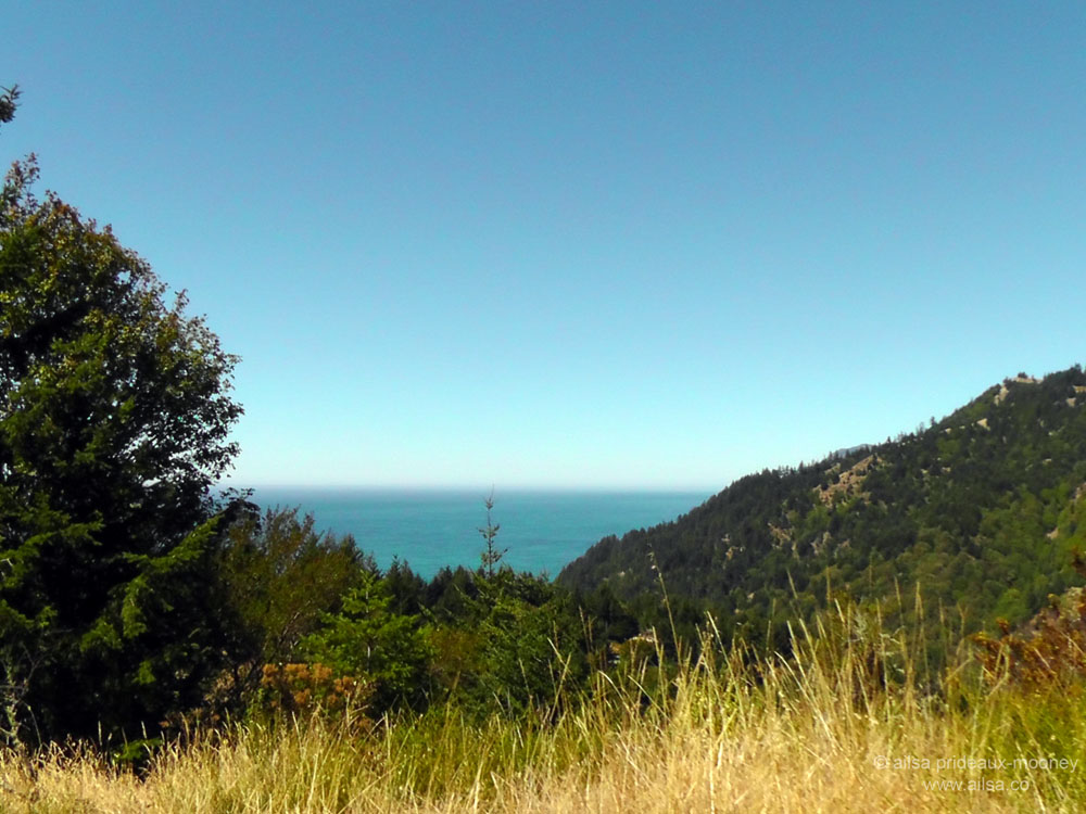
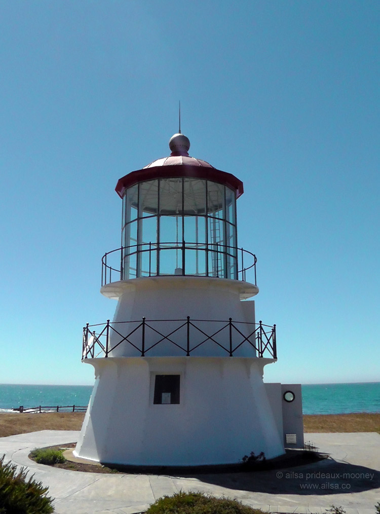
The road dropped into a steep incline now and Jill stomped on the brakes the whole way down the hill. The smell of burning rubber was a little disconcerting as the truck barrelled down the slope, but thankfully we reached the bottom before anything melted or burst into flames and we pulled in by a cheery little lighthouse at the ocean’s edge.
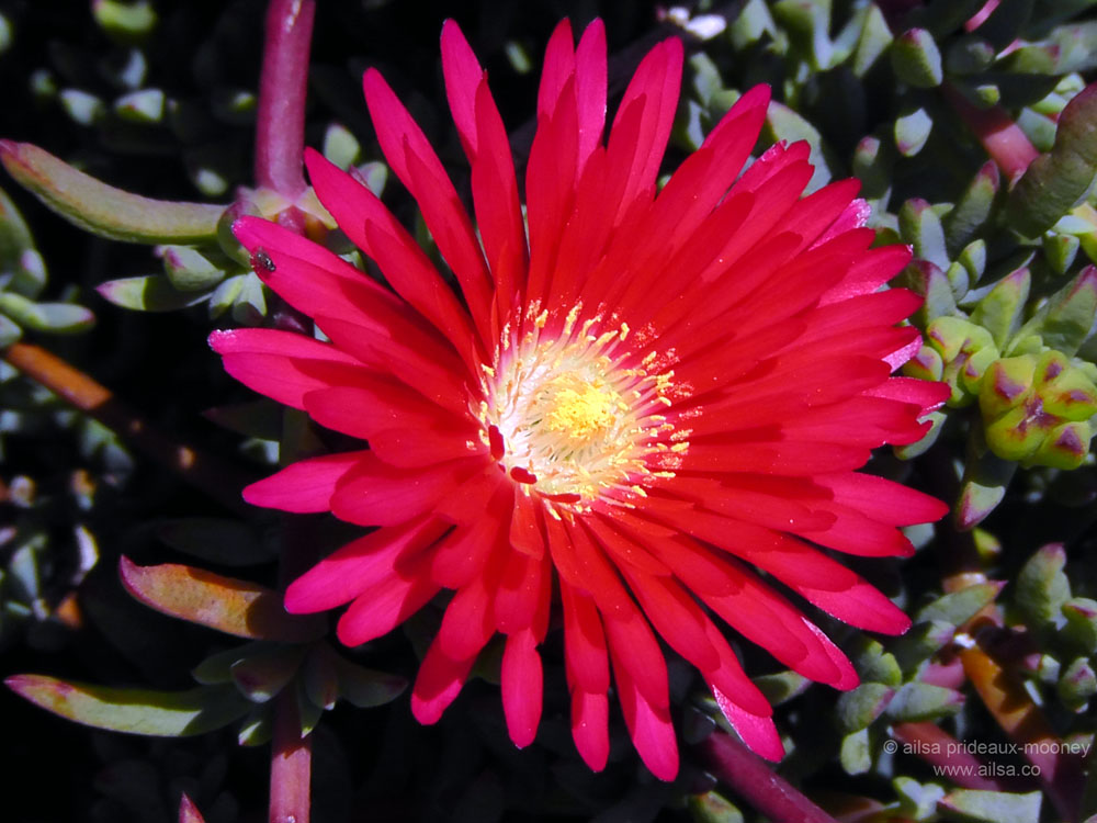
The sun was blazing down and the sea flashed bright blue sparks as we got out to have a look around. There were flowers of all sorts dancing in the sea breeze and birds flitting merrily by. It was a little slice of heaven.

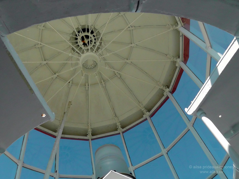
We stopped into the lighthouse to have a look around. Cape Mendocino Lighthouse has a rather unusual history. Originally located about 35 miles further north along the coast, it was moved to Shelter Cove in 1998. The fragile lantern room was unbolted from the base and flown south by an army helicopter. A small exhibit inside the lighthouse showed a dusty old photo of it in transit.

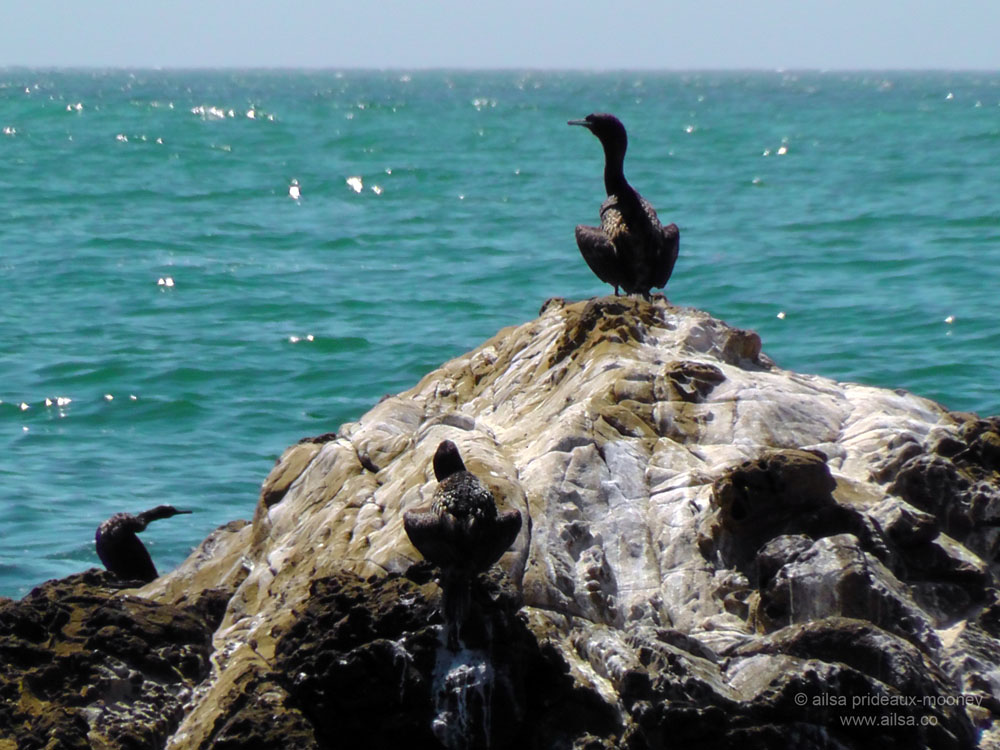
Outside, Jill wandered towards the ocean while I took a few shots of the brightly coloured flowers along the dunes. When I went to catch up with her, she was already on her way back. I climbed down the steps and was greeted by the most amazing views of the coastline. Craggy black rocks jutted out into the vibrant waters, festooned with sea lions, harbor seals, pelicans and cormorants and in the distance the coast disappeared into a delicate rosy haze. It was all kinds of wonderful.
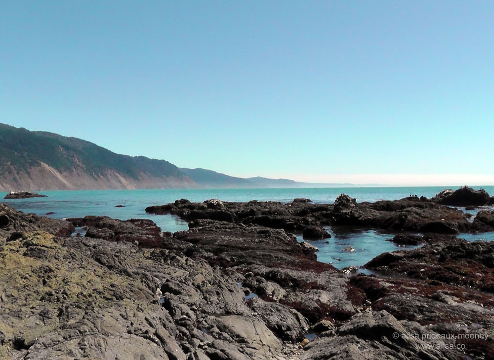


Tide pools glowed like sapphires in the crevices of the dark rocks and with the sun warming my face and the salty air filling my lungs, I wanted nothing more than to go exploring, but Jill’s absence was weighing on my mind. A couple of surfers passed by and when I shared my wonder at the beauty of this place, they told me to check out nearby Black Sand Beach before I left. I wandered back to the truck and found Jill sitting in the cab.
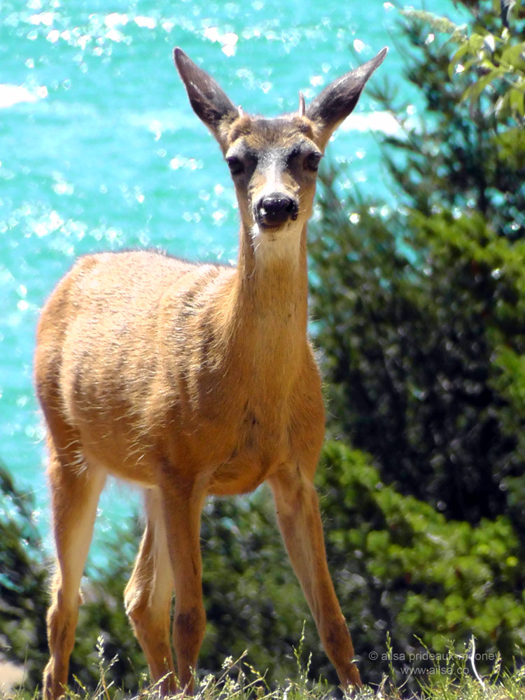
“This isn’t what I expected,” she said when I climbed in. “I was thinking we’d be driving along miles of winding coastal roads.” “You mean like Big Sur?” I asked quietly. She looked puzzled. “I thought Big Sur was an island.” I went through a mental checklist of islands that might match up, but couldn’t come up with any. “Alcatraz?” I suggested. “Maybe” she replied dolefully. I wanted to giggle but it didn’t seem appropriate. We sat there in silence for a while and then I mentioned Black Sands Beach, so we drove over to have a peek. Driving north from Shelter Cove, we spotted the most beautiful deer grazing by the side of the road and slowed down to watch for a few moments before continuing. This place is a haven for wildlife; I resolved to revisit the Lost Coast and explore it at leisure the next time I am in California.

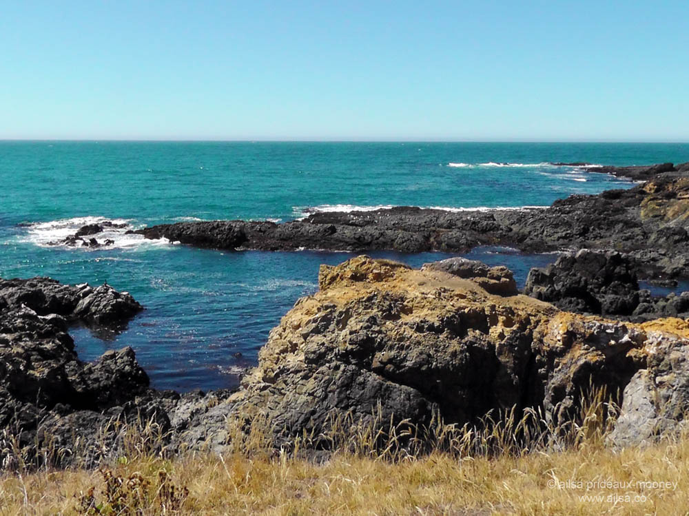
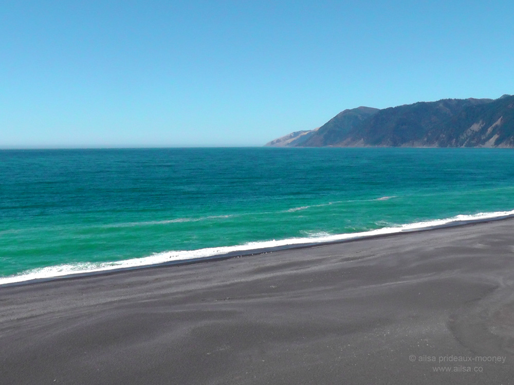
Black Sand Beach was one of the most striking beaches I have seen. Unlike many other black sand beaches around the world, the colour is not the result of volcanic activity. The dark sands are a combination of compressed shale and the predominant stone in the area; a crumbly dark grey sandstone with the delightful name greywacke. We watched from an overlook as rolling waves the colour of jade crashed into the sparkling ebony sands; the foam creating a white frill that stretched along the shoreline like a strip of lace.
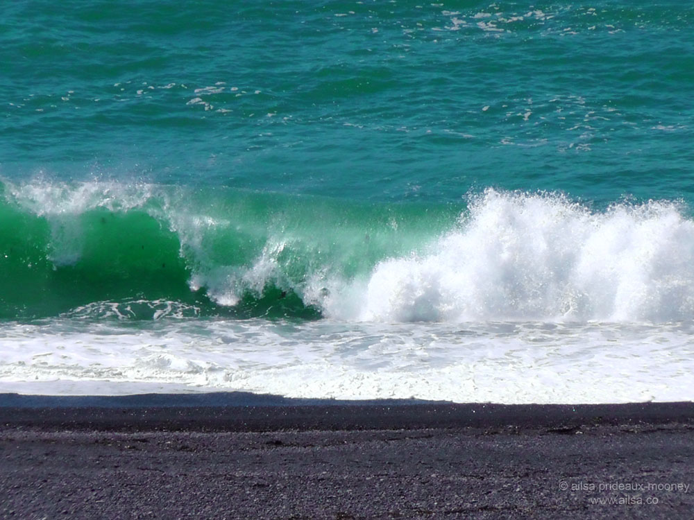
We didn’t go down to the beach; I was glad I had a pretty powerful zoom on my camera to get some close up shots of that dramatic shoreline. Jill was struggling with her disappointment and it only got worse when we stopped to talk to a woman delivering mail, who told us she doubted our truck could handle driving along Kings Peak Road, an unpaved track more suited to off-road vehicles. There is a reason why this is called the Lost Coast. It is remote, undeveloped and inaccessible to mainstream traffic; which adds to the beauty of this wilderness area. She went on to explain Kings Peak Road coursed its way through miles of forest, which wouldn’t have given Jill the coastal drive she was longing for. Jill was inconsolable now, and worried that she had burned out the brakes on the truck, so we left the Lost Coast after little more than an hour and took the long road back to Highway 101. As our little truck groaned up the impossibly steep incline, I hoped the rest of the day would help Jill forget her disappointment, for now we were heading into Redwood country.
(Continued here.)


